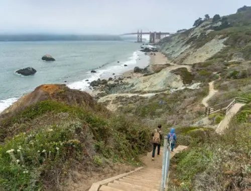
Point Bonita Trail in California is an easy trail. The hike comes with great views of the Bay Area and the opportunity to tour the Point Bonita Lighthouse.
Point Bonita Trail Location
The address for Point Bonita Trail is at the Bonita Lighthouse parking lot on Field Road in Mill Valley, California.
Trail Elevation
The elevation point for the trail reaches approximately 0.5 miles. Some spots can reach up to 200 feet in height or higher. If you like a leisurely hike with some height, Point Bonita Trail is a good option.
Point Bonita Trail Length
The trail length of Point Bonita Trail is about 0.5 miles or 0.8 kilometers.
Hiking Time
It should take you only around one hour to hike the entirety of the Point Bonita Trail. You will enjoy seeing the lighthouse and scenery on the trail. You may finish the hike quicker, but it should take a minimum of 40 minutes.
Difficulty
Generally, Point Bonita Trail is one of the easier trails to hike. It can take less than an hour to complete. It provides a nice area for walking and going bird watching. You will love seeing views of the Pacific Ocean and the lighthouse.
What Gear To Bring
The trail is wheelchair-friendly and accessible to strollers. You can bring the whole family. Bring bug spray, sunscreen, hats, and water bottles. Consider wearing long pants and sleeves to avoid bug bites. You can also bring binoculars for birdwatching.
Pets
Dogs and other pets are not allowed on Point Bonita Trail, so you cannot bring your canines with you. However, it is a kid-friendly trail that’s perfect for families. Even if you have little children, they can walk most of the trail.
Fees
Currently, evening tours of the Point Bonita Lighthouse have fees of $16 for people aged 16 and older, $8 for seniors, and $10 for children between 7 and 15 years of age.
Best Time To Go
You will find that Point Bonita Trail is perfect for any season. You can go year-round and enjoy the hike. To avoid the crowds, make sure to go in the morning or after 3:00 PM.
Parking
The Point Bonita parking lot is on the right side of Field Road in Mill Valley. The lot has handicap spaces and plenty of room for family cars.
Biking
Bikes are not allowed on the trail, but you can go on a bike ride to the entrance. There’s a place to lock up your bicycle before entering and hiking the trail.
Reviews
Most hikers give Point Bonita a positive review. The Point Bonita Lighthouse may be closed due to staffing and weather conditions. Check the status of the lighthouse before planning your hike. The easy trail has impressive views of the Bay Area.
Discover more amazing places to hike by visiting the links below:
- Adams Canyon Trail
- Aiea Loop Trail
- Ancient Lakes Trail
- Batteries to Bluffs Trail
- Big Falls Trail
- Bridle Trails State Park
- Calico Basin Trail
- Cochran Shoals Trail
- Craven Gap Trail
- Dale Ball Trails
- Devastation Trail
- Donut Falls Trailhead
- East Palisades Trail
- Endless Wall Trail
- Judd Trail
- Holy Jim Trail
- Hummingbird Trail
- Kuilau Ridge Trail
- Kuliouou Ridge Trail
- Lake Clementine Trail
- Lost Valley Trail
- Mahana Ridge Trail
- Makiki Valley Trail
- Marymere Falls Trail
- Monkey Trail
- Munds Wagon Trail
- Murray Canyon Trail
- Peters Canyon Hiking Trail
- Pink Pillbox Hike
- Poo Poo Point Trailhead
- Red Reef Trail
- River Place Nature Trail
- Tahquitz Canyon Trail
- Trail Canyon Falls
- Waterfall Hikes
- Wave Cave Trail
- Wiliwilinui Ridge Trail
Featured image via Parks Conservancy
