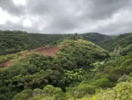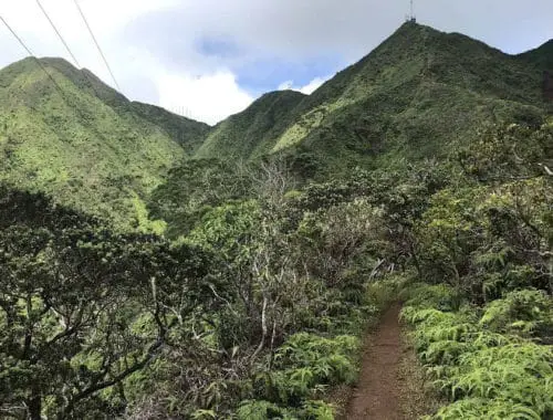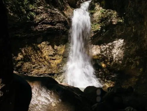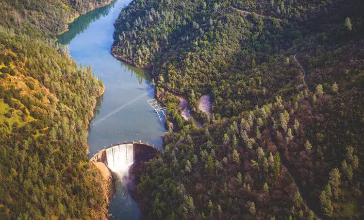
Lake Clementine trail is a moderately easy and accessible trail near Auburn, CA. It offers excellent views of the American River, access to a favorite local swimming hole, and a stunning conclusion featuring remarkable sights of the North Fork Dam.
The trail crosses under Foresthill Bridge, the tallest bridge in California, and coincides with a historic stagecoach route used during the gold rush.
Combining California history with gorgeous water views, Lake Clementine Trail is worth an afternoon outdoors.
Difficulty
Most hikers consider Lake Clementine Trail to be an easy to moderate trail. The most difficult spots are where the trail narrows due to wash out.
Distance
Lake Clementine Trail’s length is 1.9 miles out and back.
Trail Begins
Lake Clementine Trail’s location is about 3.5 miles outside Auburn, California. The trailhead is located off HWY 49, at the confluence area on the side of the Foresthill Bridge. This is 1.75 miles south of the Auburn State Recreation Association Headquarters.
You can view a Lake Clementine Trail map here. Or, for a detailed trail map, you can download California State Park’s official trail app, OuterSpacial.
Gear / What To Bring
Lake Clementine Trail is mostly shady. However, the first half-mile of the trail is in full sun, and in the summer, it can be very hot. So, bring plenty of water, a hat, and sunscreen.
At the ¾ mile mark, a side trail leads down to Clark’s Pool. Clark’s Pool is a popular local swimming hole with pristine blue water. You may want to bring a swimsuit and towel to enjoy it.
Reviews
You can read over 2,000 reviews on Lake Clementine Trail on AllTrails.com.
Pets
Dogs are welcome on Lake Clementine Trail, but they must be on a leash. However, Lake Clementine’s recreation area is not dog friendly, and no pets are allowed. So, if you plan to go on to Lake Clementine, you may want to leave your pup behind.
Fees
Hiking Lake Clementine Trail is free, but parking is $10.
Hike/Ride Time
For most hikers, Lake Clementine Trail’s length is about two hours.
Best Seasons
Lake Clementine Trail is open year-round, and you can visit it any time. However, the best time is in spring and early summer when it’s not too hot. Early fall is also an excellent time to experience the trail.
Elevation
The minimum elevation of Lake Clementine Trail is 538 feet. The maximum is 944.
Parking
Parking is located to the left of the trailhead and costs $10 for the day. Lake Clementine Trail hours are from 7 am to sunset, and the parking lot may not be available outside of that period.
It’s also important to note that this is a popular trail. So, parking is sometimes difficult, especially on weekends and during the summer. There are other recreational parking lots further down the street, but they will add to the length of your hike!
Route Type
Lake Clementine Trail is an out-and-back trail.
Bikes Allowed
Bikes, including pedal bikes, mountain bikes, and class-1 electric bikes, are allowed on Lake Clementine Trail.
Ready to explore more amazing hiking trails? Check out these articles:
- Adams Canyon Trail
- Aiea Loop Trail
- Ancient Lakes Trail
- Batteries to Bluffs Trail
- Big Falls Trail
- Bridle Trails State Park
- Calico Basin Trail
- Cochran Shoals Trail
- Craven Gap Trail
- Dale Ball Trails
- Devastation Trail
- Donut Falls Trailhead
- East Palisades Trail
- Endless Wall Trail
- Judd Trail
- Holy Jim Trail
- Hummingbird Trail
- Kuilau Ridge Trail
- Kuliouou Ridge Trail
- Lost Valley Trail
- Mahana Ridge Trail
- Makiki Valley Trail
- Marymere Falls Trail
- Monkey Trail
- Munds Wagon Trail
- Murray Canyon Trail
- Peters Canyon Hiking Trail
- Pink Pillbox Hike
- Point Bonita Trail
- Poo Poo Point Trailhead
- Red Reef Trail
- River Place Nature Trail
- Tahquitz Canyon Trail
- Trail Canyon Falls
- Waterfall Hikes
- Wave Cave Trail
- Wiliwilinui Ridge Trail