The Adams Canyon Trail is located in Uinta-Wasatch-Cache National Forest, north of Salt Lake City. It is the second most popular trail in Davis County due to its shade and accessibility.
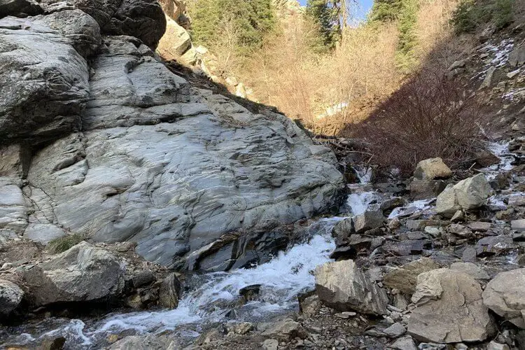
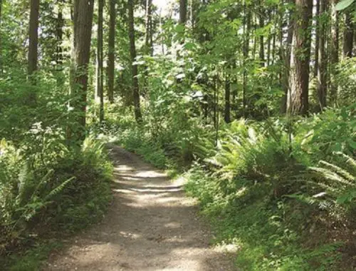
This scenic trail runs along North Fork Holmes Creek. Starting with a half-mile of steep, sandy switchbacks before entering a shady tree-covered area and ending at the 40-foot Adams Waterfall.
Adams Canyon Trail Hours
Open 24-hours a day
Fees
Free
Adams Canyon Trail Length
3.8 miles out and back
Elevation
1,430-foot elevation gain from 4,853 feet to 6,191 feet
Route Type
Out-and-back trail
Hike Time
Hike time averages 2 hours and 36 minutes, but allow time for breaks as the trail gains elevation quite quickly in some places.
Difficulty Level
This trail is moderately challenging. The first half-mile of steep switchbacks gains 500 feet of elevation. The middle section of the trail levels off, and the last part up to the waterfall is steeper again. To get the full view of the waterfall at the trail’s end, you must cross a creek.
Adams Canyon Trail Location
The trailhead is about 10 miles north of Salt Lake City. It’s east of Layton and north of Fruit Heights on Eastside Drive, just off US-89. Coordinates of the trailhead are 41.066216, -111.909978.
Parking
At Adams Canyon Trailhead just outside Layton, Utah, off North Eastside Drive
Other Transportation Allowed
Bikes, horses, and non-motorized vehicles are allowed.
Restrooms
Restroom facilities are not available on the trail or in the parking area.
History
Adams Canyon, named after Ellias Adams, a relative of John Adams, second president of the U.S. Ellias Adams staked a claim at East Bench in Layton, Utah, in 1850. A memorial is located on the second switchback of the trail.
Pets
Dogs are welcome on the Adams Canyon Trail. Reviews have indicated that dog owners not picking up their dogs’ waste has become an issue on the trail.
Best Seasons
Late spring, summer, and fall are best, but the trail is open year-round and offers views in all seasons.
Precautions
Do not hike above the falls as the terrain is very steep and slippery. Most rescues on the trail happen when people try to hike above the falls.
Rattlesnakes and tarantulas have been spotted, but they are more common on the side trails.
Key Views
Adams Waterfall – 40-foot waterfall at the end of the trail
Views into the valley, especially at sunset
Gear/To Bring
Standard hiking gear is all that is needed. The basics include:
- Good hiking boots or shoes
- Sufficient water
- First aid kit
- Sunscreen
- Insect repellent
- Any clothing needed for potential weather changes.
Navigation tools should not be necessary for this trail as it is marked and well-traveled, but if any side trails are in the plan, navigation or an Adams Canyon Trail map could be beneficial.
Reviews
Some of the reviews of the Adams Canyon Trail say that it is dry and sandy at the beginning, but after the first half-mile, it’s shady and follows a creek. Reviewers say that the waterfall view at the trail’s end is well worth the hike.
Conclusion
The Adams Canyon trail is a great hike for anyone looking for an adventure and a great view. The moderate difficulty makes it the perfect option for hikers with some experience.
Check out these links for info on other trails you’ll want to see:
- Aiea Loop Trail
- Ancient Lakes Trail
- Batteries to Bluffs Trail
- Big Falls Trail
- Bridle Trails State Park
- Calico Basin Trail
- Cochran Shoals Trail
- Craven Gap Trail
- Dale Ball Trails
- Devastation Trail
- Donut Falls Trailhead
- East Palisades Trail
- Endless Wall Trail
- Judd Trail
- Holy Jim Trail
- Hummingbird Trail
- Kuilau Ridge Trail
- Kuliouou Ridge Trail
- Lake Clementine Trail
- Lost Valley Trail
- Mahana Ridge Trail
- Makiki Valley Trail
- Marymere Falls Trail
- Monkey Trail
- Munds Wagon Trail
- Murray Canyon Trail
- Peters Canyon Hiking Trail
- Pink Pillbox Hike
- Point Bonita Trail
- Poo Poo Point Trailhead
- Red Reef Trail
- River Place Nature Trail
- Tahquitz Canyon Trail
- Trail Canyon Falls
- Waterfall Hikes
- Wave Cave Trail
- Wiliwilinui Ridge Trail
